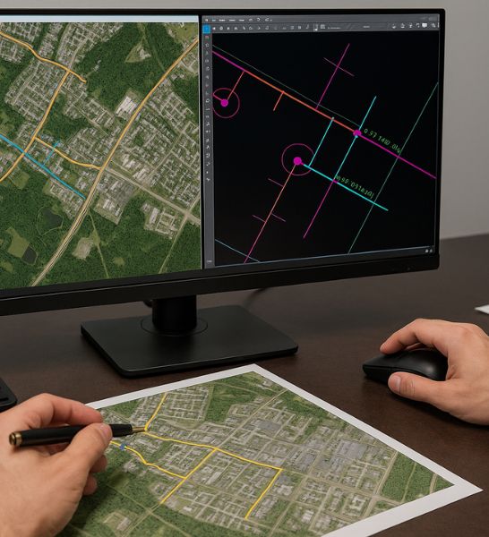
GIS Mapping and Cad Drafting
Under our comprehensive Fiber Design Services, Eureka Telecom provides highly accurate GIS Mapping and CAD Drafting solutions to support efficient fiber network planning, deployment, and management. These tools enable real-time visualization, streamlined permitting, and precision-based design documentation for new or existing fiber infrastructure.
Our team uses advanced GIS software to map fiber routes, pole locations, handholes, splice points, and customer access points with precise geospatial data. This ensures clear coordination between field teams, municipalities, and project stakeholders. Simultaneously, our CAD drafting team develops detailed design drawings—including trench profiles, conduit layouts, and fiber schematics—that comply with local and industry standards.
Whether you’re rolling out a new FTTH network or upgrading an urban fiber ring, Eureka’s GIS and CAD solutions provide the technical foundation for accuracy, speed, and long-term asset tracking.
Key Highlights
Accurate Fiber Route Mapping
Leverage GIS-based layouts with GPS-tagged field data to ensure precise fiber path planning. This approach enhances network design accuracy, streamlines deployment, and reduces errors, providing a reliable foundation for efficient fiber infrastructure development.
CAD-Based Network Drafting
We provide precise CAD drafting for telecom and utility networks, covering conduits, handholes, splice enclosures, and drop points. Our detailed engineering drawings ensure accuracy, compliance, and efficiency, supporting seamless project execution and reducing installation errors.
As-Built & Permit-Ready Plans
Professionally drafted, digitally approved plans tailored for construction, permitting, and utility coordination. Designed to meet compliance standards, streamline approvals, and ensure accuracy for smooth project execution.
Layered Design Visualization
Comprehensive multi-level mapping with aerial, underground, and micro-trenching perspectives, enabling clear visualization of complex infrastructure layouts.
Integration with Field Surveys
Seamlessly capture and integrate site survey data directly into GIS and CAD platforms. This ensures real-time accuracy, reduces manual entry, and streamlines project workflows. Field inputs instantly sync with digital systems, enabling better analysis, faster decision-making, and improved collaboration across teams.
Ongoing Asset Management Support
We provide structured GIS data optimized for asset lifecycle management, ensuring smooth maintenance, efficient expansion planning, and accurate fault tracing to improve reliability and decision-making.